the end
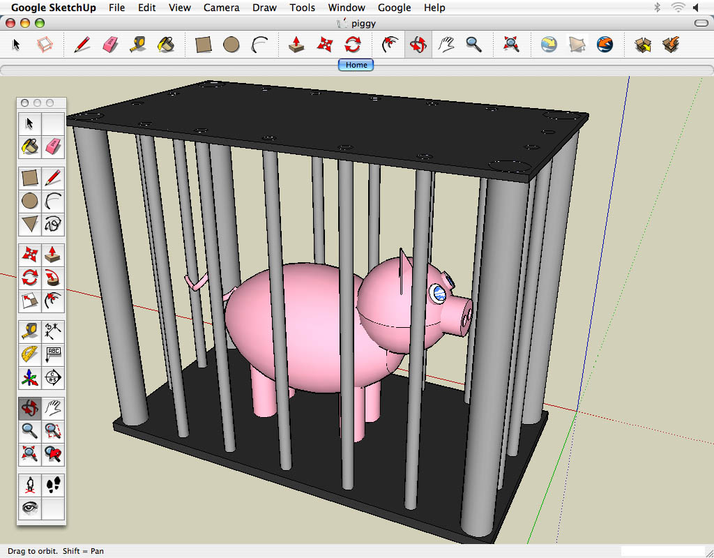
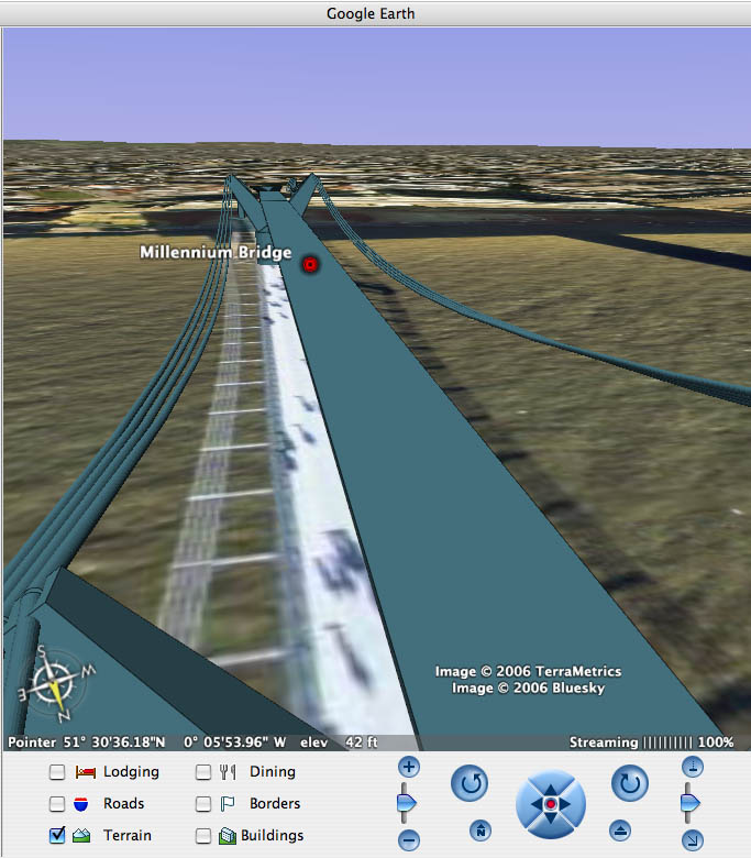
Well, it is my last evening here in Berlin and I’m sitting in a sketchy Internet cafe a couple blocks from our apartments. I absolutely cannot believe that this program is over. Yet I still have a whole month before I go back home, and I think it’s actually going to be weird being in cities and not having to worry about classes and projects and all that stuff. Overall, I’m very happy with how this program went. I had never made new media before, and I actually didn’t really know what new media was, but here I am, nine weeks later, with a term full of experiences abroad. The only physical evidence I have to show for it is a folder of photos, this blog, and a pretty awesome Google Earth map showing my perceptions of some of my favorite places. If somebody had told me at the beginning of September that I will have not only spent hundreds of hours on a project, but enjoyed making it and felt proud of my piece, I think I would have been a bit surprised. I don’t consider myself to be much of an artist or a programmer, but it turns out you don’t really have to be either to make art. You just need an idea and the motivation to carry it out to the best of your ability. And that’s what I did.
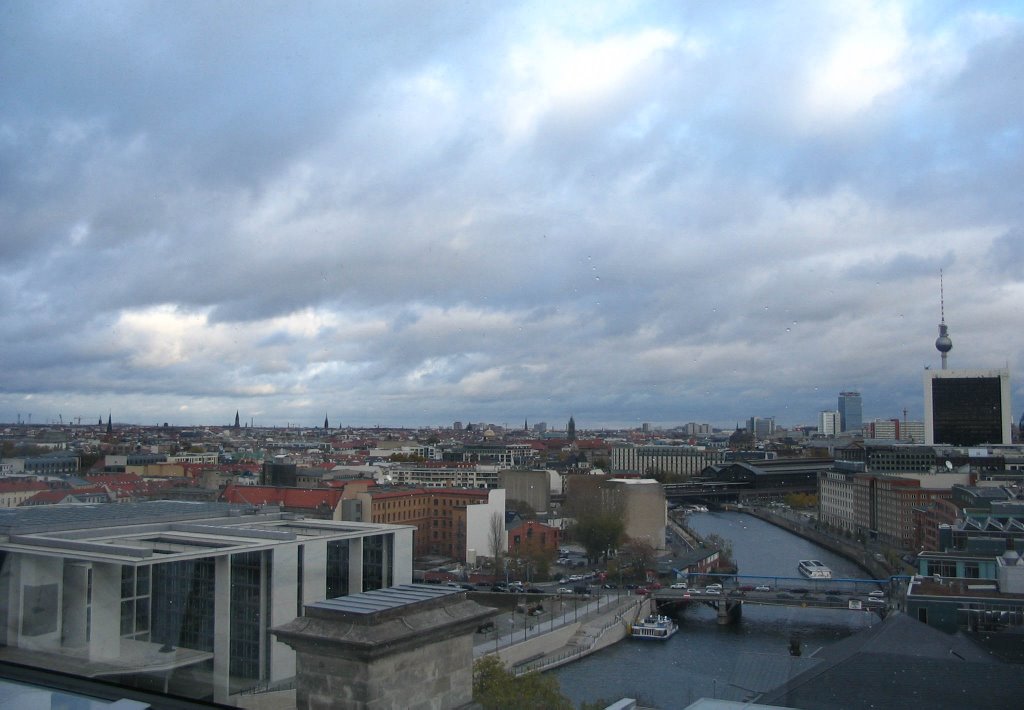
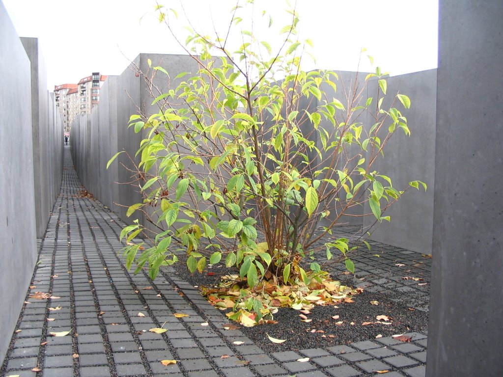
This weekend, I got to do a bit of the more tourist-y Berlin stuff because Joe and I wanted to go collect some footage to work into our project later. We went back to the Holocaust Memorial, and then we waited in long lines to go to the top of the Reichstag and the big tower at Alexanderplatz that must have a name, but I don’t know wha t it is. Both of them had amazing views of the city, and of course, I took a ton of pictures. At right, looking east from the Reichstag. There’s little droplets of water on it because it started to rain, and it was so windy up there that it made me feel like I was snowboarding. Yes, that’s an odd association, but that’s what came to mind at the time. Below is a shot I took from the dome on top of the Reichstag, and I like it because the sun is peeking through the clouds in a really interesting way, and then up in the clouds you can see reflections of the mirrors in the dome behind me.
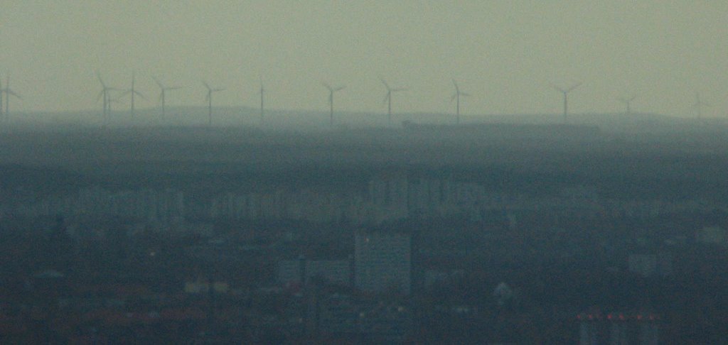
The tower in Alexanderplatz was slightly less impressive because it felt so dark and enclosed. However, I could see so much of the city from there, and it really made me feel small seeing how much I was surrounded by. I only traversed a tiny part of that during my two weeks here. Up in the tower, they have those big binocular-like machines, so we picked our favorite area of the city and forked out 1 euro to see it in a bit more detail. I think I managed to find our apartment building with it, which was pretty neat. Below is a photo I took through it of wind turbines way out on the horizon. The city seemed to just end out there and blend in with the fog, but there were these turbines cranking away.
This might be my last post for a while because I’m not really sure what my Internet situation will be like for the next month. Tomorrow morning, it’s off to Prague, and then on Friday down to Vienna. Then we’re going to Copenhagen to visit some Carleton friends and apparently I’ve been assigned to cook the Thanksgiving turkey. That should be interesting.
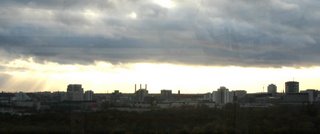
This weekend, I got to do a bit of the more tourist-y Berlin stuff because Joe and I wanted to go collect some footage to work into our project later. We went back to the Holocaust Memorial, and then we waited in long lines to go to the top of the Reichstag and the big tower at Alexanderplatz that must have a name, but I don’t know wha
 t it is. Both of them had amazing views of the city, and of course, I took a ton of pictures. At right, looking east from the Reichstag. There’s little droplets of water on it because it started to rain, and it was so windy up there that it made me feel like I was snowboarding. Yes, that’s an odd association, but that’s what came to mind at the time. Below is a shot I took from the dome on top of the Reichstag, and I like it because the sun is peeking through the clouds in a really interesting way, and then up in the clouds you can see reflections of the mirrors in the dome behind me.
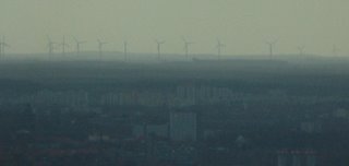
The tower in Alexanderplatz was slightly less impressive because it felt so dark and enclosed. However, I could see so much of the city from there, and it really made me feel small seeing how much I was surrounded by. I only traversed a tiny part of that during my two weeks here. Up in the tower, they have those big binocular-like machines, so we picked our favorite area of the city and forked out 1 euro to see it in a bit more detail. I think I managed to find our apartment building with it, which was pretty neat. Below is a photo I took through it of wind turbines way out on the horizon. The city seemed to just end out there and blend in with the fog, but there were these turbines cranking away.
This might be my last post for a while because I’m not really sure what my Internet situation will be like for the next month. Tomorrow morning, it’s off to Prague, and then on Friday down to Vienna. Then we’re going to Copenhagen to visit some Carleton friends and apparently I’ve been assigned to cook the Thanksgiving turkey. That should be interesting.
| Permalink | ![]()


