brilliance
Okay, so I am really excited about this.
It might not actually be brilliant, because it was late last night when we came up with it, but I think it's a pretty interesting way of setting up our website and presenting the project. We were trying to write a short overview of the project to put on the very front page of the website, as kind of a way to capture the attention of people, and provide information for those who don't want to read all of our more detailed stuff. I was having a hard time explaining to Joe what I envisioned for this text, and halfway through writing it, it hit me: it was an ABSTRACT!!! And with all of my science/social science background, that idea is way exciting, because that implies that it's introducing some sort of research. That got us to thinking, hey, maybe our project is research, and we really think that it is. It's research into the idea of using traditional mapping platforms (ie Google Earth) as an artistic platform, and our writing thus far about the project has even been pretty close to fitting into the frame I would use for a typical psych research paper. So, I think we're going to set up the website under that framework, presenting our project as an artistic form of research. It still needs some tweaking, but it's seeming like it will fit fairly well into that format. The evolution of mapping essay I posted is the "background" of the project. The project itself is the "results" section. The thing we were working on last night is definitely the "abstract," although it is not quite polished yet, and we are going to be writing a "discussion" that brings together our feelings on the project itself and its place in the larger scope of things. The last part of a research paper, and probably my favorite to write because of how simple it is, is the "methods" section. And voila, our art is a form of research! So, here is the most recent section we have completed. For the rest of them (and the polished product), you will just have to wait for the website. I'm not entirely sure when that will be up, because we want it to look good, but a link will definitely end up here when it is ready.
Methods:
During the nine weeks we spent studying in New York, London, Amsterdam, and Berlin, we selected places that stood out as being notable in our experience of each city as a whole. For each of these places, we built a 3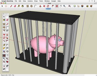 -D model in Google SketchUp that portrays the place, either in an architecturally accurate manner, or a more artistic one. We then created a project in the place, using various digital mediums and software. These media projects were intended to capture the place as we experienced it, creating a snapshot as a record for others to view and understand the elements of place that most stood out to us. The models were imported into Google Earth, and we placed links on them that led to the media projects hosted online. By combining these individual places into one single map, our entire journey is chronicled and archived, and our experience of place can be followed by anybody who is interested.
It might not actually be brilliant, because it was late last night when we came up with it, but I think it's a pretty interesting way of setting up our website and presenting the project. We were trying to write a short overview of the project to put on the very front page of the website, as kind of a way to capture the attention of people, and provide information for those who don't want to read all of our more detailed stuff. I was having a hard time explaining to Joe what I envisioned for this text, and halfway through writing it, it hit me: it was an ABSTRACT!!! And with all of my science/social science background, that idea is way exciting, because that implies that it's introducing some sort of research. That got us to thinking, hey, maybe our project is research, and we really think that it is. It's research into the idea of using traditional mapping platforms (ie Google Earth) as an artistic platform, and our writing thus far about the project has even been pretty close to fitting into the frame I would use for a typical psych research paper. So, I think we're going to set up the website under that framework, presenting our project as an artistic form of research. It still needs some tweaking, but it's seeming like it will fit fairly well into that format. The evolution of mapping essay I posted is the "background" of the project. The project itself is the "results" section. The thing we were working on last night is definitely the "abstract," although it is not quite polished yet, and we are going to be writing a "discussion" that brings together our feelings on the project itself and its place in the larger scope of things. The last part of a research paper, and probably my favorite to write because of how simple it is, is the "methods" section. And voila, our art is a form of research! So, here is the most recent section we have completed. For the rest of them (and the polished product), you will just have to wait for the website. I'm not entirely sure when that will be up, because we want it to look good, but a link will definitely end up here when it is ready.
Methods:
During the nine weeks we spent studying in New York, London, Amsterdam, and Berlin, we selected places that stood out as being notable in our experience of each city as a whole. For each of these places, we built a 3
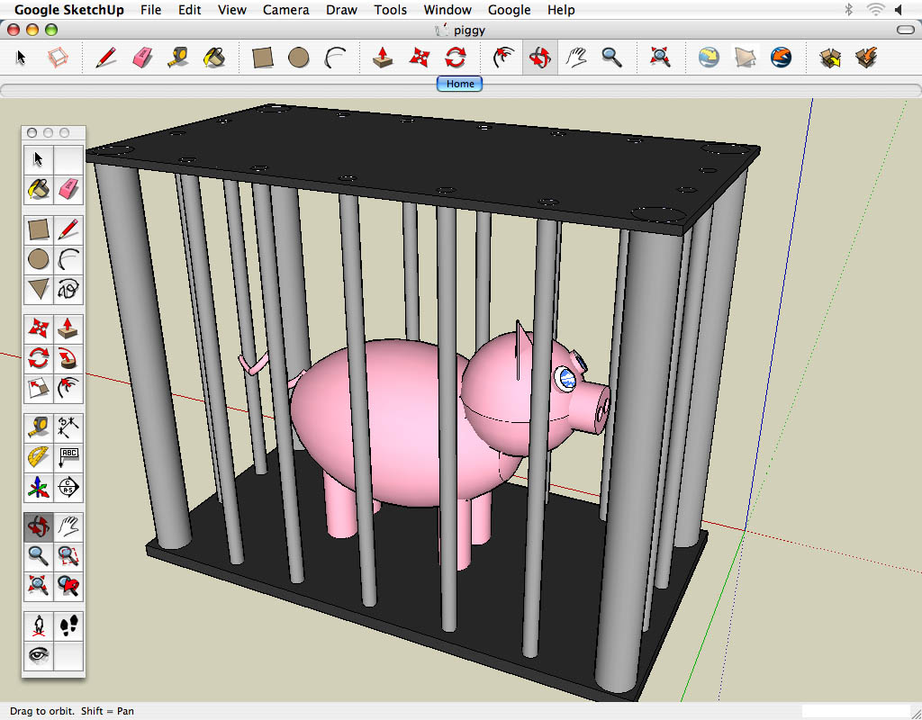 -D model in Google SketchUp that portrays the place, either in an architecturally accurate manner, or a more artistic one. We then created a project in the place, using various digital mediums and software. These media projects were intended to capture the place as we experienced it, creating a snapshot as a record for others to view and understand the elements of place that most stood out to us. The models were imported into Google Earth, and we placed links on them that led to the media projects hosted online. By combining these individual places into one single map, our entire journey is chronicled and archived, and our experience of place can be followed by anybody who is interested.